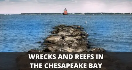
Location Of Wrecks, Reefs And Fishing Hot Spots On The Chesapeake Bay
UPDATED 17 MAY 2023
by Robert Ceran
Below is a table showing the location of wrecks, reefs, and fishing hotspots on the Chesapeake Bay (given as GPS coordinates).
| Wreck, Reef, Or Fishing Hotspot Name | Latitude | Longitude |
|---|---|---|
| 1800 Line Wreck-Console 350'x46'x16' | 36 28.260N | 75 37.260W |
| 13- Green 13 Buoy (Cape Charles) | 37 06.258N | 76 00.376W |
| 21 Mile Hill | 37 26.321N | 75 11.981W |
| 26 Mile Hill | 37 14.460N | 75 10.510w |
| 44 Fathom Wrk Washing BB-478 624' | 36 54.505N | 74 41.908W |
| 4A - Floating Drydock | 36 35.707N | 75 41.263W |
| 4A Bouy | 37 00.290N | 75 55.084W |
| 50 Fathom Wreck | 37 22.201N | 74 34.055W |
| 53 Fathom Wreck | 37 41.953N | 74 19.504W |
| 61 Fathom Wreck | 37 20.766N | 74 30.878W |
| 63 Fathom Wreck | 37 11.391N | 74 34.356W |
| 66 Fathom Wreck | 37 20.654N | 74 29.631W |
| 73 Fathom Wreck | 37 26.407N | 74 30.272W |
| 75' Stones | 37 45.922N | 75 14.731W |
| Airplane 747 | 36 52.581N | 74 53.517W |
| Allegheny - Barge | 37 32.212N | 75 24.681W |
| Ammo Loading Pier | 36 58.551N | 76 21.254W |
| Ammo Ship | 37 44.205N | 74 59.375W |
| Anglo African | 37 03.275N | 75 53.336W |
| Angler Reef | 37 43.899N | 75 52.689W |
| Atlantic Mist | 37 54.926N | 75 02.970W |
| B. A. Van Brunt | 36 55.120N | 74 42.580W |
| Back River Reef | 37 08.176N | 76 13.534W |
| Baltimore Channel | 37 03.739N | 76 04.834W |
| Barge Steel | 36 53.741N | 75 42.828W |
| Barnegat - Barge | 37 33.510N | 75 24.246W |
| Birch Lake | 37 15.182N | 75 36.834W |
| Birchlake | 37 15.087N | 75 36.620W |
| Blackfish Bank Reef | 37 49.856N | 75 14.582W |
| Bluefish Alley | 36 39.079N | 75 29.451W |
| Bluefish Rock | 37 04.623N | 76 13.182W |
| Boatseaking Was On | 36 59.808N | 75 21.609W |
| Boiler Wreck | 37 58.913N | 74 59.063W |
| Bone Wreck | 37 45.547N | 75 11.247W |
| Boxcar - Old Bridge Piling #60 (NCAR) | 37 03.255N | 76 02.345W |
| Brazil | 37 03.314N | 75 51.082W |
| Brazil | 37 03.213N | 75 51.053W |
| Brazil Frt 308'x48'x18' | 37 51.690N | 76 09.037W |
| Brass Spike | 36 55.818N | 75 33.866W |
| Buarque | 36 10.952N | 74 58.277W |
| Buarque | 36 17.967N | 75 02.515W |
| Buarque 390'x54'x32' | 36 15.837N | 74 51.936W |
| Byron Benson 465'x60'x36' | 36 08.622N | 75 14.083W |
| Cabbage Patch Reef | 37 10.311N | 76 02.964W |
| Cape Charles 36A | 37 14.946N | 76 03.406W |
| Cape Henry Wreck-Chilore 550'x72'x44' | 36 57.503N | 76 00.036W |
| Cayahoga 125'x24'x8' CGC | 36 57.658N | 75 22.172W |
| CBJ Buoy - New C Buoy | 36 56.007N | 75 56.846W |
| CBBT 1st Island | 36 58.038N | 76 06.731W |
| CBBT 4th Island | 37 02.781N | 76 03.737W |
| CBBT 12 Mile Marker | 37 04.163N | 76 01.993W |
| CBBT High Rise | 37 05.305N | 75 58.937W |
| CBBT Small Boat Channel | 36 56.980N | 76 07.049W |
| Cell | 37 24.108N | 76 03.151W |
| Chenago | 36 27.379N | 74 56.179W |
| Chenango 432'x46'x22' | 36 27.283N | 74 55.987W |
| Cherry Stone Reef | 37 19.118N | 76 02.261W |
| Chesapeake Light Tower | 36 54.066N | 75 42.215W |
| Chesapeake Tower Wreck | 36 54.893N | 75 43.087W |
| Chesapeake Tower Wreck | 36 53.616N | 75 43.024W |
| Chesapeake Twr Dry Docks | 36 53.890N | 75 42.720W |
| Chesapeake Light Tower Reef | 36 53.914N | 75 42.758W |
| Chesapeake Light Tower Reef | 36 53.874N | 75 42.727W |
| Chesapeake Light Tower Reef | 36 53.939N | 75 42.700W |
| Chris F | 37 28.357N | 74 34.600W |
| Clam Boat | 37 49.623N | 75 05.288W |
| Clam Trawler | 37 46.899N | 74 41.103W |
| Clark (Liberty Ship) (Triangle Wreck) | 36 58.919N | 75 20.902W |
| Clark | 36 59.035N | 75 21.141W |
| Clark | 37 05.127N | 76 01.991W |
| Clythia | 36 33.910N | 75 50.379W |
| Coast Guard Barge (Parramore Reef) | 37 32.434N | 75 25.775W |
| Corrolla | 36 22.214N | 75 45.910W |
| Concrete Ship | 37 05.383N | 75 36.242W |
| Cut Channel Southern | 37 32.143N | 76 02.474W |
| Cut Channel Northern | 37 40.400N | 76 09.390W |
| Concrete Ships (Kiptopeke) | 37 09.899N | 75 59.637W |
| Cuyahoga-USCG 125' (Triangle Wreck) | 36 57.650N | 75 22.175W |
| David Atwater-Collier | 37 56.868N | 75 05.751W |
| David Atwater-Collier 550' | 37 56.976N | 75.05.609W |
| Deco | 36 55.910N | 74 38.395W |
| Dolly Parton-Gulf Hustler | 36 48.926N | 75 21.486W |
| Dorothy | 37 51.500N | 76 09.231W |
| Doxie Girl | 37 08.128N | 75 34.490W |
| Doxie Girl | 36 57.803N | 74 37.915W |
| Dry Dock-4a | 36 35.703N | 75 41.289W |
| E.R. Smith | 37 49.129N | 75 23.524W |
| Eastern Shore Ship Shoal Inlet | 37 10.605N | 75 47.229W |
| Edgar Clark | 36 58.919N | 75 20.902W |
| Edna | 37 28.782N | 74 50.457W |
| Eidsvold | 36 55.000N | 74 59.580W |
| Elevens | 37 48.780N | 74 51.494W |
| Empire Gem | 35 01.323N | 75 27.914W |
| Ent. Buoy #1 | 36 56.564N | 76 04.065W |
| Ent. Buoy #1 | 36 55.037N | 76 04.862W |
| Equipose 429'x54'x34' | 36 10.955N | 74 58.250W |
| Ethel C | 37 25.813N | 74 40.594W |
| Ethel C 328'x44'x19' | 37 25.826N | 74 40.081W |
| Ethel C Frt-328' | 37 25.918N | 74 40.670W |
| Eureka (Hang) | 36 40.044N | 74 53.253W |
| Eureka 351'x42'x32' | ||
| Eureka Frt-351' | 36 43.457N | 74 44.643W |
| Faye | 36 54.570N | 75 50.530W |
| Fingers | 37 00.023N | 75 06.287W |
| Fort Wool | 36 59.262N | 76 18.068W |
| Fishermans Island Wreck 370'x48'x19' | 37 03.275N | 75 53.552W |
| Fishermans Island Wreck Anglo African | 37 03.448N | 75 53.984W |
| Galaga | 38 01.245N | 75 15.335W |
| Garrison (Triangle Wreck) | 36 59.323N | 75 21.131W |
| Gemini | 37 03.275N | 75 53.552W |
| Gulf Hustler | 36 51.447N | 75 35.702W |
| Gulf Hustler Tkr | 36 51.461N | 75 35.721W |
| Gun Boat | 38 35.750N | 74 39.020W |
| Gwynns Island Reef | 37 28.744N | 76 13.722W |
| Hampton Roads Bridge Tunnel | 36 59.894N | 76 18.966W |
| Hampton Bar | 36 59.646N | 76 19.998W |
| Hanks | 36 43.441N | 75 33.571W |
| Hanks-Magnet-Trawler | 36 43.465N | 75 33.513W |
| Hans | 37 51.057N | 75 03.197W |
| Haviland (Triangle Wreck) | 36 59.187N | 75 21.180W |
| Haviland (Triangle Wreck) | 36 59.288N | 75 21.237W |
| Hermod Steamship 85' | 37 51.862N | 75 02.901W |
| Hermod Stern | 37 51.698N | 75 01.532W |
| Hole Off West Tip Fisherman Island | 37 04.296N | 75 55.729W |
| Hopper Barge | 36 54.010N | 75 43.250W |
| Hot Ditch | 36 45.738N | 76 18.320W |
| Hot Dog | 36 45.630N | 75 17.459W |
| Hump | 37 10.289N | 76 10.090W |
| Inis Paradine | 37 00.792N | 74 40.105W |
| Isabelle Paramenter | 36 53.021N | 74 44.989W |
| Isabelle Paramenter | 36 54.330N | 74 51.649W |
| Isabelle Paramenter | 36 52.597N | 74 44.279W |
| James River Bridge | 37 00.214N | 76 28.074W |
| John Morgan | 36 59.948N | 75 23.984W |
| John Morgan | 36 59.811N | 75 23.824W |
| John Morgan (Bridge) | 36 59.890N | 75 23.865W |
| Keiths | 36 51.679N | 75 29.695W |
| Kingston Ceylonite | 36 49.473N | 75 51.539W |
| Latimer Shoal | 37 07.576N | 75 59.866W |
| Lawson | 37 04.273N | 74 46.651W |
| Lchnbach 448'x60'x28' | 36 58.243N | 75 24.231W |
| Liberty Ship, Page (Parramore Reef) | 37 32.000N | 75 26.275W |
| Liberty Ship, Mona Isle (Parramore Reef) | 37 31.830N | 75 26.420W |
| Lillian Luckenbach | 38 23.635N | 74 52.617W |
| Lost Dredge | 37 24.341N | 74 41.778W |
| Lt. Ship Wreck | 37 55.543N | 74 55.578W |
| Madrugada Schooner 229' | 37 48.816N | 74 45.209W |
| Marine Electric - Stern | 37 52.727N | 74 46.204W |
| Marine Electric -Bow | 37 52.803N | 74 46.079W |
| Meat Cleaver | 37 02.245N | 75 32.792W |
| Menominee | 37 30.398N | 75 26.644W |
| Merida Frt 400' | 37 23.592N | 74 40.714W |
| Metropolis 500 tons, RR Iron | 36 39.675N | 75 52.447W |
| Middle Grounds | 37 04.348N | 76 01.451W |
| Miss Pauline | 37 12.833N | 74 44.923W |
| Mona Island | 37 31.641N | 75 25.899W |
| Monitor Merrimack Tunnel | 36 56.896N | 76 24.303W |
| Monroe Frt 345' | 37 35.487N | 75 14.207W |
| Morgan Bridge 423'x57'34' | 36 59.940N | 75 23.893W |
| Muriel Alene Trawler | 37 49.623N | 75 05.288W |
| Nancy | 36 42.489N | 74 49.972W |
| Nancy F | 36 05.452N | 75 20.978W |
| Nassawadox Reef | 37 29.379N | 76 00.333W |
| New Winds | 35 57.304N | 74 53.138W |
| Newport News Middleground Reef #1 | 36 56.617N | 76 23.459W |
| Newport News Middleground Reef #2 | 36 56.628N | 76 23.536W |
| Newport News Middleground Reef #3 | 36 56.760N | 76 23.597W |
| Newport News Middleground Reef #4 | 36 56.719N | 76 23.566W |
| Nikes Wreck #2 | 36 56.709N | 76 02.341W |
| Nikes Wreck Turn of Century | 36 54.085N | 75 52.901W |
| Nine Foot Shoal | 37 04.977N | 76 00.504W |
| Nordhav | 36 30.038N | 74 47.000W |
| Norfolk Canyon | 37 05.910N | 74 37. 397W |
| North of Tower | 37 01.463N | 75 42.299W |
| Northern Neck Reef | 37 48.069N | 76 09.293W |
| Norweigan Frt - Stern | 37 51.731N | 75 01.519W |
| Norweigan Frt - Bow | 37 51.495N | 75 02.382W |
| O B Jennings | 36 40.079N | 74 53.243W |
| OB Jennings 500'x68x38' | 36 40.044N | 74 53.253W |
| Occohannock Reef | 37 34.350N | 76 00.699W |
| Ocean Venture 425'x57'x34 | 35 54.430N | 75 16.555W |
| Ocean Venture Frt 425' | 37 04.166N | 74 55.127W |
| ODU (East Oceanview Reef) | 36 56.529N | 76 11.454W |
| Old Vessel - Paddle Wheeler | 36 58.469N | 75 23.143W |
| Ostfriesland BB 546' | 37 09.144N | 74 34.055W |
| Otho | 35 13.259N | 75 41.690W |
| Paddle Wheeler | 36 58.711N | 75 23.383W |
| Parking Lot | 37 41.210N | 74 52.420W |
| Party Boat | 37 31.783N | 75 32.793W |
| Patty B | 37 47.590N | 74 40.893W |
| Paul Russell | 37 59.293N | 74 48.824W |
| Piece of Steel | 37 03.273N | 74 40.368W |
| Plantation Light | 37 13.733N | 76 02.809W |
| Powell wreck | 36 49.054N | 75 23.849W |
| Prince of Peace | 36 42.990N | 74 50.235W |
| Queen | 37 41.321N | 75 12.058W |
| Ramada (Right of the Ramada) | ???? | ???? |
| Ricks | 36 47.672N | 75 28.916W |
| Ricks Trawler | 36 47.642N | 75 28.950W |
| River Front Junction | 36 48.449N | 75 25.925W |
| Rock Pile (Grandview) | 37 05.246N | 76 16.202W |
| Rogest | 37 00.482N | 75 38.916W |
| Rogest | 37 00.325N | 75 38.979W |
| Russian Trawler | 36 05.630N | 74 56.030W |
| Russian Trawler-Luke confirmed | 36 05.611N | 74 56.035W |
| Sail Boat | 37 48.299N | 74 56.549W |
| Sail Boat | 37 42.703N | 74 47.496W |
| Salty Sea | 36 49.553N | 75 40.792W |
| San Delfine 463'x61'x33' | 35 37.124N | 74 52.783W |
| Sand Stone | 37 01.779N | 74 39.489W |
| Sanner- Dean's Bump 140'x21'x1' | 36 57.471N | 76 00.691W |
| Santore 449'x57'x34' | 36 53.712N | 75 46.256W |
| Schooner | 37 40.832N | 74 35.410W |
| Schooner | 36 52.166N | 74 50.652W |
| Seventy-Five Ft. Stone | 36 22.891N | 74 55.635W |
| Smith Island Flats | 37 05.866N | 75 51.646W |
| Snoopy | 37 45.922N | 75 14.731W |
| Spring Chicken | 36 20.329N | 74 54.229W |
| Spring Chicken 100'x22'x10' | 36 50.985N | 75 10.873W |
| Stanchion Wreck | 36 50.825N | 75 34.617W |
| Stanchion-Near Tower | ||
| Starr, Jessie W. | 37 33.162N | 74 39.124W |
| Stone Barge | 37 45.547N | 75 11.247W |
| Stormy | 36 51.440N | 75 47.020W |
| Tercel | 36 57.919N | 75 20.886W |
| Tercel Tug | 36 57.924N | 75 20.861W |
| Texaco Tkr (Bay Ent) | 37 14.879N | 76 04.566W |
| Thimble Shoal Light | 37 00.865N | 76 14.371W |
| Tiger (Piece) | 36 45.859N | 75 45.735W |
| Tiger Tkr 410' | 36 45.797N | 75 45.686W |
| Trepca | 36 59.688N | 75 23.892W |
| Triangle LCM | 36 59.761N | 75 22.046W |
| Triangle LCM | ||
| Tug | 37 50.045N | 75 14.757W |
| Tug | 37 49.974N | 75 19.741W |
| Tug Winthrop | 36 54.233N | 75 53.492W |
| Turcel | 36 58.193N | 75 21.502W |
| Turnof Century-William Thorp 95'x24'x12' | 36 54.061N | 75 52.862W |
| U-111 German Sub | 37 45.300N | 74 07.700W |
| U-85 218'x20'x15' | 35 54.430N | 75 16.555W |
| U-Boat - 140 | 37 09.702N | 74 44.686W |
| Unidentified | 37 09.393N | 74 33.904W |
| Unidentified | 37 36.386N | 74 53.886W |
| Unknown | 37 32.777N | 74.21.739W |
| Unknown | 37 28.452N | 74 33.820W |
| Unknown | 37 27.252N | 74 27.355W |
| Unknown | 37 26.407N | 74 30.272W |
| Unknown | 37 25.446N | 74 40.041W |
| Unknown | 37 28.890N | 75 16.617W |
| Unknown | 37.22.201N | 74 34.055W |
| Unknown | 37 28.595N | 75 28.770W |
| Unknown | 37 18.862N | 74 44.009W |
| Unknown | 37 14.877N | 74 28.695W |
| Unknown | 37 11.731N | 74 44.949W |
| Unknown | 37 03.600N | 75 50.478W |
| Unknown | 36 57.458N | 75 40.466W |
| Unknown | 36 55.137N | 75 29.312W |
| Unknown | 36 43.834N | 74 44.989W |
| Unknown | 36 59.755N | 74 47.126W |
| Unknown At Triangle | 36 59.332N | 75 21.478W |
| Unknown At Triangle | 36 59.421N | 75 22.962W |
| Unknown Barge | 36 59.747N | 75 22.121W |
| Vicky | 36 55.320N | 74 50.500W |
| Wachapreague Reef | 37 32.768N | 75 31.869W |
| Wachapreague Reef | 37 32.256N | 75 32.283W |
| Webster (Triangle Wreck) | 36 59.422N | 75 21.026W |
| Westmoreland | 36 56.615N | 75 56.897W |
| Wolf Trap | 37 23.427N | 76 11.382W |
| Yancey | 36 57.530N | 76 06.893W |
| York River Bridge | 37 14.555N | 76 30.424W |
| York Spit | 37 12.580N | 76 15.628W |
| York 253'x43'26' | 36 03.626N | 75 12.989W |